اتوود (کانزاس)
Atwood, Kansas | |
|---|---|
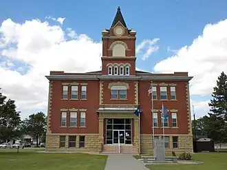 Rawlin County Courthouse, 2010 | |
| شعار: "Pride of the Prairie" | |
 Location of Atwood, Kansas | |
| مختصات: ۳۹°۴۸′۳۲″ شمالی ۱۰۱°۲′۲۹″ غربی / ۳۹٫۸۰۸۸۹°شمالی ۱۰۱٫۰۴۱۳۹°غربی | |
| کشور | آمریکا |
| ایالت | کانزاس |
| شهرستان | Rawlins |
| مساحت | |
| • کل | ۱٫۱۰ مایل مربع (۲٫۸۵ کیلومتر مربع) |
| • خشکی | ۱٫۰۴ مایل مربع (۲٫۶۹ کیلومتر مربع) |
| • آب | ۰٫۰۶ مایل مربع (۰٫۱۶ کیلومتر مربع) |
| ارتفاع | ۲۸۵۸ فوت (۸۷۱ متر) |
| جمعیت (۲۰۱۰) | |
| • کل | ۱۱۹۴ |
| • برآورد (۲۰۱۱[۲]) | ۱۱۹۱ |
| • تراکم | ۱۱۴۸٫۱/مایل مربع (۴۴۳٫۳/کیلومتر مربع) |
| منطقهٔ زمانی | یوتیسی -۶ (Central (CST)) |
| • تابستانی (DST) | یوتیسی -۵ (CDT) |
| زیپکد | ۶۷۷۳۰ |
| کد منطقه | ۷۸۵ |
| FIPS کد | ۲۰-۰۳۱۵۰[۳] |
| GNIS feature ID | ۰۴۷۰۹۹۱[۴] |
| وبگاه | AtwoodKansas.com |
اتوود (به انگلیسی: Atwood) شهری در ایالت کانزاس کشور ایالات متحده آمریکا است که جمعیت آن در سرشماری سال ۲۰۱۰ میلادی، ۱٬۱۹۴ نفر بودهاست.[۵]
جستارهای وابسته
منابع
- ↑ "US Gazetteer files 2010". United States Census Bureau. Archived from the original on 14 July 2012. Retrieved 2012-07-06.
- ↑ "Population Estimates". United States Census Bureau. Archived from the original on 18 September 2012. Retrieved 2013-01-03.
{{cite web}}: External link in|publisher= - ↑ "American FactFinder". اداره آمار آمریکا. Retrieved 2008-01-31.
- ↑ "US Board on Geographic Names". سازمان نقشهبرداریهای زمینشناسی آمریکا. 2007-10-25. Retrieved 2008-01-31.
- ↑ "kansas" (به انگلیسی). factfinder2.census. Retrieved 29 Jan 2013.