ارین (تنسی)
Erin, Tennessee | |
|---|---|
| نام مستعار: Irish Town Tennessee | |
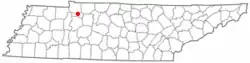 Location in the state of تنسی | |
| کشور | ایالات متحده آمریکا |
| State | تنسی |
| شهرستان | Houston |
| Settled | approx. 1780 |
| حکومت | |
| • شهردار | Tommy Parchman (I) [۱] |
| مساحت | |
| • کل | ۴٫۱۰ مایل مربع (۱۰٫۶۲ کیلومتر مربع) |
| • خشکی | ۴٫۱۰ مایل مربع (۱۰٫۶۲ کیلومتر مربع) |
| • آب | ۰٫۰۰ مایل مربع (۰٫۰۰ کیلومتر مربع) |
| ارتفاع | ۴۸۰ فوت (۱۴۶ متر) |
| جمعیت (2000)[۲] | |
| • کل | ۱٬۴۹۰ |
| • تراکم | ۳۶۳٫۶/مایل مربع (۱۴۰٫۳/کیلومتر مربع) |
| منطقهٔ زمانی | یوتیسی -۶ (CST) |
| • تابستانی (DST) | یوتیسی -۵ (CDT) |
| ZIP code | 37061 |
| کد منطقه | 931 |
| FIPS code | 47-24320[۳] |
| GNIS feature ID | 1283839[۴] |
| وبگاه | ErinTennessee.com |
ارین(به انگلیسی: Erin) شهری در ایالت تنسی کشور ایالات متحده آمریکا است که جمعیت آن در سرشماری سال ۲۰۱۰ میلادی، ۱٬۳۲۴ نفر بودهاست.[۵]
جستارهای وابسته
منابع
- ↑ "City of Erin Offices & Aldermen". Houston County Chamber of Commerce. Archived from the original on 7 February 2012. Retrieved July 6, 2007.
- ↑ "Tennessee by Place - GCT-PH1. Population, Housing Units, Area, and Density: 2000". U.S. Census Bureau. Archived from the original on 12 February 2020. Retrieved July 6, 2007.
- ↑ "American FactFinder". اداره آمار آمریکا. Retrieved 2008-01-31.
- ↑ "US Board on Geographic Names". سازمان نقشهبرداریهای زمینشناسی آمریکا. 2007-10-25. Retrieved 2008-01-31.
- ↑ "United States of America: largest cities and towns and statistics of their population" (به انگلیسی). world-gazetteer. Archived from the original on 23 April 2013. Retrieved 29 Jan 2013.