سایمونز تاون
سایمونز تاون
Simonstad | |
|---|---|
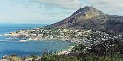 View of Simon's Town | |
| کشور | آفریقای جنوبی |
| استان | Western Cape |
| ناحیه | City of Cape Town |
| Established | ۱۶۸۰[۱] |
| همنام | Simon van der Stel |
| حکومت | |
| • Councillor | Simon Liell-Cock (DA) |
| مساحت | |
| • کل | ۱۹٫۸۱ کیلومتر مربع (۷٫۶۵ مایل مربع) |
| جمعیت (2011)[۲] | |
| • کل | ۶٬۵۶۹ |
| • تراکم | ۳۳۰/کیلومتر مربع (۸۶۰/مایل مربع) |
| درصد نژادی (۲۰۱۱) | |
| • Black African | 24.5% |
| • رنگینپوستان | 12.7% |
| • Indian/Asian | 4.4% |
| • White | 56.4% |
| • Other | 2.0% |
| زبان نخست (۲۰۱۱) | |
| • انگلیسی | 68.0% |
| • آفریکانس | 18.5% |
| • خوسایی | 3.6% |
| • زولو | 2.4% |
| • Other | 7.5% |
سایمونز تاون (به لاتین: Simon's Town) یک شهرک در آفریقای جنوبی است که در کیپ غربی واقع شدهاست.[۳]
نگارخانه
_p046_VIEW_OF_SIMONS_BAY.jpg) Simon's Bay - Naval Base, 1806
Simon's Bay - Naval Base, 1806 The South African Naval Base in Simon's Town.
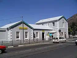 Simon's Town station
 Admiralty House
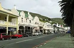 The historical centre of Simon's Town
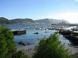 View of the harbour with the civilian yacht moorings in the foreground and the naval base to the right in the background.
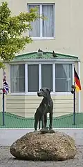 Statue of Just Nuisance in Simon's Town
- A flight around Roman Rock Lighthouse just outside Simon's Town harbour
جستارهای وابسته
منابع
- ↑ Robson, Linda Gillian (6 September 2011). "Annexure A [Chronological order of town establishment in South Africa...]". The Royal Engineers and Settlement Planning in the Cape Colony 1806–1872: Approach, Methodology and Impact (PDF) (Ph.D.). University of Pretoria. p. xlv. Retrieved 24 June 2012.
- 1 2 3 4 "Main Place سایمونز تاون". Census 2011.
- ↑ مشارکت کنندگان ویکیپدیای انگلیسی. «Simon's Town».
پیوند به بیرون
در ویکیانبار پروندههایی دربارهٔ سایمونز تاون موجود است.