لا یونیون
لا یونیون، پرو | |
|---|---|
 Welcome Arch of La Union at the La Union-Ilocos Sur border | |
 پرچم  مهر | |
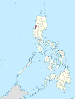 موقعیت لا یونیون، پرو در نقشه | |
| مختصات: ۱۶°۳۰′ شمالی ۱۲۰°۲۵′ شرقی / ۱۶٫۵۰۰°شمالی ۱۲۰٫۴۱۷°شرقی | |
| کشور | |
| Region | Region I |
| تأسیسشده | ۲ مارس ۱۸۵۰ |
| پایتخت | San Fernando City |
| حکومت | |
| • فرماندار | Manuel "Manoling" C. Ortega (NPC) |
| مساحت | |
| • کل | ۱٬۴۹۷٫۷۰ کیلومتر مربع (۵۷۸٫۲۷ مایل مربع) |
| • رتبه | 68th out of 80 |
| جمعیت (2010)[۲] | |
| • کل | ۷۴۱٬۹۰۶ |
| • رتبه | 37th out of 80 |
| • تراکم | ۵۰۰/کیلومتر مربع (۱۳۰۰/مایل مربع) |
| • رتبه | 10th out of 80 |
| Divisions | |
| • Independent cities | 0 |
| • Component cities | 1 |
| • Municipalities | 19 |
| • Barangay | 576 |
| • Districts | 1st and 2nd districts of La Union |
| منطقهٔ زمانی | یوتیسی +۸ (PHT) |
| ZIP code | 2500 – 2520 |
| Dialing code | 72 |
| زبانها | زبان ایلوکانو , زبان پانگاسینانی، Kankanaey، Ibaloi، زبان تاگالوگ، زبان انگلیسی |
| وبگاه | launion.gov.ph |
لا یونیون، پرو (به لاتین: La Union) یک استانهای فیلیپین در فیلیپین است که در Ilocos Region واقع شدهاست. [۳]
خصوصیات
لا یونیون ۱٬۴۹۷٫۷۰ کیلومترمربع مساحت و ۷۴۱٬۹۰۶ نفر جمعیت دارد.
جستارهای وابسته
منابع
- ↑ "List of Provinces". PSGC Interactive. Makati City, Philippines: National Statistical Coordination Board. Archived from the original on 12 September 2016. Retrieved 30 July 2013.
- ↑ "Population and Annual Growth Rates for The Philippines and Its Regions, Provinces, and Highly Urbanized Cities" (PDF). 2010 Census and Housing Population. National Statistics Office. Archived from the original (PDF) on 28 September 2013. Retrieved 30 July 2013.
- ↑ مشارکت کنندگان ویکیپدیای انگلیسی. «La Union».