مدسین لاج (کانزاس)
Medicine Lodge, Kansas | |
|---|---|
 Location of Medicine Lodge, Kansas | |
 Detailed map of Medicine Lodge, Kansas | |
| مختصات: ۳۷°۱۷′۴″ شمالی ۹۸°۳۴′۵۲″ غربی / ۳۷٫۲۸۴۴۴°شمالی ۹۸٫۵۸۱۱۱°غربی | |
| کشور | آمریکا |
| ایالت | کانزاس |
| شهرستان | Barber |
| Founded | ۱۸۷۳ |
| Incorporated | ۱۸۷۹ |
| مساحت | |
| • کل | ۱٫۲۱ مایل مربع (۳٫۱۳ کیلومتر مربع) |
| • خشکی | ۱٫۲۱ مایل مربع (۳٫۱۳ کیلومتر مربع) |
| • آب | ۰ مایل مربع (۰ کیلومتر مربع) |
| ارتفاع | ۱۴۹۶ فوت (۴۵۶ متر) |
| جمعیت (۲۰۱۰) | |
| • کل | ۲۰۰۹ |
| • برآورد (۲۰۱۱[۲]) | ۲۰۲۰ |
| • تراکم | ۱۶۶۰٫۳/مایل مربع (۶۴۱٫۰/کیلومتر مربع) |
| منطقهٔ زمانی | یوتیسی -۶ (Central (CST)) |
| • تابستانی (DST) | یوتیسی -۵ (CDT) |
| زیپکد | ۶۷۱۰۴ |
| کد منطقه | ۶۲۰ |
| FIPS کد | ۲۰-۴۵۵۰۰[۳] |
| GNIS feature ID | ۰۴۷۰۴۴۶[۴] |
| وبگاه | City website |
مدسین لاج (به انگلیسی: Medicine Lodge) شهری در ایالت کانزاس کشور ایالات متحده آمریکا است که جمعیت آن در سرشماری سال ۲۰۱۰ میلادی، ۲٬۰۰۹ نفر بودهاست.[۵]
جستارهای وابسته
منابع
- ↑ "US Gazetteer files 2010". United States Census Bureau. Archived from the original on 20 February 2011. Retrieved 2012-07-06.
- ↑ "Population Estimates". United States Census Bureau. Archived from the original on 18 September 2012. Retrieved 2013-01-03.
{{cite web}}: External link in|publisher= - ↑ "American FactFinder". اداره آمار آمریکا. Retrieved 2008-01-31.
- ↑ "US Board on Geographic Names". سازمان نقشهبرداریهای زمینشناسی آمریکا. 2007-10-25. Retrieved 2008-01-31.
- ↑ "kansas" (به انگلیسی). factfinder2.census. Retrieved 29 Jan 2013.
شهرداریها و جوامع شهرستان باربر، کانزاس، ایالات متحده | ||
|---|---|---|
| شهرها | 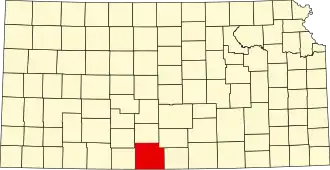 | |
| محدوده ثبتنشده |
| |
| تاونشیپها |
| |