هرینگتون (کانزاس)
Herington, Kansas | |
|---|---|
 Location of Herington, Kansas | |
 Detailed map of Herington, Kansas | |
| مختصات: ۳۸°۴۰′۱۹″ شمالی ۹۶°۵۶′۴۴″ غربی / ۳۸٫۶۷۱۹۴°شمالی ۹۶٫۹۴۵۵۶°غربی | |
| کشور | آمریکا |
| ایالت | کانزاس |
| Counties | Dickinson, Morris |
| حکومت | |
| • نوع | Mayor–Council |
| مساحت | |
| • کل | ۵٫۰۹ مایل مربع (۱۳٫۱۸ کیلومتر مربع) |
| • خشکی | ۵٫۰۶ مایل مربع (۱۳٫۱۱ کیلومتر مربع) |
| • آب | ۰٫۰۳ مایل مربع (۰٫۰۸ کیلومتر مربع) |
| ارتفاع | ۱۳۵۵ فوت (۴۱۳ متر) |
| جمعیت (۲۰۱۰) | |
| • کل | ۲۵۲۶ |
| • برآورد (۲۰۱۱[۲]) | ۲۵۲۵ |
| • تراکم | ۴۹۹٫۲/مایل مربع (۱۹۲٫۷/کیلومتر مربع) |
| منطقهٔ زمانی | یوتیسی -۶ (Central (CST)) |
| • تابستانی (DST) | یوتیسی -۵ (CDT) |
| زیپکد | ۶۷۴۴۹ |
| کد منطقه | ۷۸۵ |
| FIPS کد | ۲۰-۳۱۴۰۰[۳] |
| GNIS feature ID | ۰۴۷۶۹۹۱[۴] |
| وبگاه | City website |
هرینگتون (به انگلیسی: Herington) شهری در ایالت کانزاس کشور ایالات متحده آمریکا است که جمعیت آن در سرشماری سال ۲۰۱۰ میلادی، ۲٬۵۲۶ نفر بودهاست.[۵]
جستارهای وابسته
منابع
- ↑ "US Gazetteer files 2010". United States Census Bureau. Archived from the original on 14 July 2012. Retrieved 2012-07-06.
- ↑ "Population Estimates". United States Census Bureau. Archived from the original on 18 September 2012. Retrieved 2013-01-03.
{{cite web}}: External link in|publisher= - ↑ "American FactFinder". اداره آمار آمریکا. Retrieved 2008-01-31.
- ↑ "US Board on Geographic Names". سازمان نقشهبرداریهای زمینشناسی آمریکا. 2007-10-25. Retrieved 2008-01-31.
- ↑ "kansas" (به انگلیسی). factfinder2.census. Retrieved 29 Jan 2013.
شهرداریها و جوامع شهرستان دیکینسون، کانزاس، ایالات متحده | ||
|---|---|---|
| شهرها | 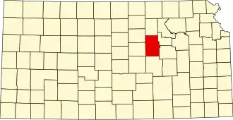 | |
| سیدیپیها | ||
| محدوده ثبتنشده |
| |
| تاونشیپها |
| |
| پانویسها | ‡قسمتهایی از این منطقه مسکونی در شهرستانهای اطراف قرار دارد | |