هنگلو
Hengelo | |
|---|---|
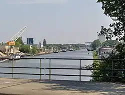 Twentekanaal through Hengelo | |
 پرچم  نشان | |
.svg.png) Location in Overijssel | |
| مختصات: ۵۲°۱۶′ شمالی ۶°۴۸′ شرقی / ۵۲٫۲۶۷°شمالی ۶٫۸۰۰°شرقی | |
| کشور | هلند |
| استان | افریسل |
| حکومت | |
| • نهاد | Municipal council |
| • Mayor | Sander Schelberg (VVD) |
| مساحت | |
| • کل | ۶۱٫۸۳ کیلومتر مربع (۲۳٫۸۷ مایل مربع) |
| • خشکی | ۶۰٫۸۴ کیلومتر مربع (۲۳٫۴۹ مایل مربع) |
| • آب | ۰٫۹۹ کیلومتر مربع (۰٫۳۸ مایل مربع) |
| ارتفاع | ۱۸ متر (۵۹ فوت) |
| جمعیت (ژانویه 2019)[۴] | |
| • کل | ۸۰٬۶۸۳ |
| • تراکم | ۱٬۳۲۶/کیلومتر مربع (۳۴۳۰/مایل مربع) |
| اهلیتنام | Hengeloër |
| منطقهٔ زمانی | یوتیسی +۱ (زمان) |
| • تابستانی (DST) | یوتیسی +۲ (ساعت تابستانی اروپای مرکزی) |
| Postcode | ۷۵۵۰–۷۵۵۹ |
| Area code | ۰۷۴ |
| وبگاه | www |
هنگلو شهری در شرق کشور هلند است.

در ویکیانبار پروندههایی دربارهٔ هنگلو موجود است.
نگارخانه


پانویس
- ↑ "drs. Schelberg, Sander W.J.G" (به هلندی). Gemeente Hengelo. Retrieved 29 March 2014.
{{cite web}}: Cite has empty unknown parameter:|trans_title=(help) - ↑ "Kerncijfers wijken en buurten 2020" [Key figures for neighbourhoods 2020]. StatLine (به هلندی). CBS. 24 July 2020. Retrieved 19 September 2020.
- ↑ "Postcodetool for 7551EC". Actueel Hoogtebestand Nederland (به هلندی). Het Waterschapshuis. Archived from the original on 21 September 2013. Retrieved 29 March 2014.
{{cite web}}: Cite has empty unknown parameter:|trans_title=(help) - ↑ "Bevolkingsontwikkeling; regio per maand" [Population growth; regions per month]. CBS Statline (به هلندی). CBS. 1 January 2019. Retrieved 1 January 2019.