پارکرفیلد (کانزاس)
Parkerfield, Kansas | |
|---|---|
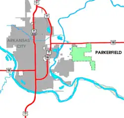 Detailed map of Parkerfield | |
| مختصات: ۳۷°۴′۳۰″ شمالی ۹۷°۰′۱۱″ غربی / ۳۷٫۰۷۵۰۰°شمالی ۹۷٫۰۰۳۰۶°غربی | |
| کشور | آمریکا |
| ایالت | کانزاس |
| شهرستان | Cowley |
| Township | Creswell |
| Incorporated | ۱۶ مارس ۲۰۰۴ |
| مساحت | |
| • کل | ۰٫۹۴ مایل مربع (۲٫۴۳ کیلومتر مربع) |
| • خشکی | ۰٫۹۴ مایل مربع (۲٫۴۳ کیلومتر مربع) |
| • آب | ۰ مایل مربع (۰ کیلومتر مربع) |
| ارتفاع | ۱۱۴۲ فوت (۳۴۸ متر) |
| جمعیت | |
| • کل | ۴۲۶ |
| • برآورد (۲۰۱۱[۴]) | ۴۲۴ |
| • تراکم | ۴۵۳٫۲/مایل مربع (۱۷۵٫۰/کیلومتر مربع) |
| منطقهٔ زمانی | یوتیسی -۶ (Central (CST)) |
| • تابستانی (DST) | یوتیسی -۵ (CDT) |
| زیپکد | 67005 (Arkansas City) |
| کد منطقه | ۶۲۰ |
| FIPS کد | ۲۰–۵۴۵۶۰ [۲] |
| GNIS feature ID | ۲۰۶۱۸۳۱ [۲] |
| وبگاه | ParkerfieldKS.org |
پارکرفیلد (به انگلیسی: Parkerfield) شهری در ایالت کانزاس کشور ایالات متحده آمریکا است که جمعیت آن در سرشماری سال ۲۰۱۰ میلادی، ۴۲۶ نفر بودهاست.[۵]
جستارهای وابسته
منابع
- ↑ "US Gazetteer files 2010". United States Census Bureau. Archived from the original on 14 July 2012. Retrieved 2012-07-06.
- 1 2 3 "US Board on Geographic Names". سازمان نقشهبرداریهای زمینشناسی آمریکا. 2007-10-25. Retrieved 2008-01-31.
- ↑ "American FactFinder". United States Census Bureau. Retrieved 2012-07-06.
{{cite web}}: External link in|publisher= - ↑ "Population Estimates". United States Census Bureau. Archived from the original on 18 September 2012. Retrieved 2013-01-03.
{{cite web}}: External link in|publisher= - ↑ "kansas" (به انگلیسی). factfinder2.census. Retrieved 29 Jan 2013.