اورتلی (داکوتای جنوبی)
Ortley, South Dakota | |
|---|---|
 Location in Roberts County and the state of داکوتای جنوبی | |
| مختصات: ۴۵°۱۹′۵۸″ شمالی ۹۷°۱۱′۵۱″ غربی / ۴۵٫۳۳۲۷۸°شمالی ۹۷٫۱۹۷۵۰°غربی | |
| کشور | ایالات متحده آمریکا |
| State | داکوتای جنوبی |
| شهرستان | Roberts |
| Incorporated | 1906[۱] |
| مساحت | |
| • کل | ۲٫۲۴ مایل مربع (۵٫۸۰ کیلومتر مربع) |
| • خشکی | ۲٫۲۴ مایل مربع (۵٫۸۰ کیلومتر مربع) |
| • آب | ۰ مایل مربع (۰ کیلومتر مربع) |
| ارتفاع | ۱۸۷۳ فوت (۵۷۱ متر) |
| جمعیت | |
| • کل | ۶۵ |
| • برآورد (2011[۴]) | ۶۶ |
| • تراکم | ۲۹٫۰/مایل مربع (۱۱٫۲/کیلومتر مربع) |
| منطقهٔ زمانی | یوتیسی -۶ (Central (CST)) |
| • تابستانی (DST) | یوتیسی -۵ (CDT) |
| زیپکد | ۵۷۲۵۶ |
| کد منطقه | 605 |
| FIPS code | 46-47660[۵] |
| GNIS feature ID | 1256907[۶] |
اورتلی(به انگلیسی: Ortley) شهری در ایالت داکوتای جنوبی کشور ایالات متحده آمریکا است که جمعیت آن در سرشماری سال ۲۰۱۰ میلادی، ۶۵ نفر بوده است.[۷]
جستارهای وابسته
منابع
- ↑ "SD Towns" (PDF). South Dakota State Historical Society. Retrieved 2010-02-14.
- ↑ "US Gazetteer files 2010". United States Census Bureau. Archived from the original on 14 July 2012. Retrieved 2012-06-21.
- ↑ "American FactFinder". United States Census Bureau. Retrieved 2012-06-21.
- ↑ "Population Estimates". United States Census Bureau. Archived from the original on 18 September 2012. Retrieved 2013-01-05.
{{cite web}}: External link in|publisher= - ↑ "American FactFinder". اداره آمار آمریکا. Retrieved 2008-01-31.
- ↑ "US Board on Geographic Names". سازمان نقشهبرداریهای زمینشناسی آمریکا. 2007-10-25. Retrieved 2008-01-31.
- ↑ "United States of America: largest cities and towns and statistics of their population" (به انگلیسی). world-gazetteer. Archived from the original on 23 April 2013. Retrieved 29 Jan 2013.
شهرداریها و جوامع شهرستان رابرتس، داکوتای جنوبی، ایالات متحده | ||
|---|---|---|
مرکز شهرستان: سیستون | ||
| شهر | 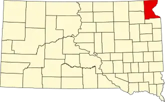 | |
| شهرکs | ||
| حوزه سرشماری |
| |
| شهرها |
| |
| محدوده ثبتنشده |
| |
| منطقه اختصاصی سرخپوستی |
| |
| پانویس و منابع | ‡This populated place also has portions in an adjacent county or counties | |