سنت-کریستین، کبک
سَنت-کریستین Sainte-Christine | |
|---|---|
Parish municipality | |
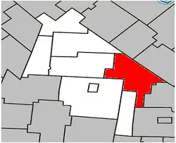 Location within Acton Regional County Municipality | |
  سَنت-کریستین Sainte-Christine | |
| مختصات: ۴۵°۳۶′۰۰″ شمالی ۷۲°۲۵′۴۸″ غربی / ۴۵٫۶۰۰۰۰°شمالی ۷۲٫۴۳۰۰۰°غربی | |
| Country |  کانادا کانادا |
| استان |  استان کبک استان کبک |
| ناحیه | مونترژی |
| منطقه شهری | Acton |
| Constituted | January 8, 1894 |
| حکومت | |
| • شهردار | Huguette St-Pierre-Beaulac |
| • Federal riding | Saint-Hyacinthe—Bagot |
| • Prov. riding | Saint-Hyacinthe—Bagot |
| مساحت | |
| • کل | ۹۱٫۸۰ کیلومتر مربع (۳۵٫۴۴ مایل مربع) |
| • خشکی | ۹۲٫۴۳ کیلومتر مربع (۳۵٫۶۹ مایل مربع) |
| There is an apparent contradiction between two authoritative sources | |
| جمعیت | |
| • کل | ۶۷۳ |
| • تراکم | ۷٫۳/کیلومتر مربع (۱۹/مایل مربع) |
| • Change (2006–11) |  ۱۲٫۹٪ ۱۲٫۹٪ |
| • Dwellings | ۲۸۷ |
| منطقهٔ زمانی | یوتیسی −۵ (EST) |
| • تابستانی (DST) | یوتیسی −۴ (EDT) |
| Postal code(s) | J0H 1H0 |
| کد منطقه | 819 |
| Access Routes[۴] |  Route ۱۱۶ Route ۱۱۶ Route ۲۲۲ Route ۲۲۲ |
| وبگاه | www |
سَنت-کریستین (به فرانسوی: Sainte-Christine) قصبهای در منطقه شهری اکتون ناحیه مونترژی در استان کبک کانادا است. در سرشماری سال ۲۰۱۱ این قصبه ۷۵۵ نفر جمعیت داشتهاست و مساحت آن ۸۹٫۴ کیلومتر مربع است.[۵]
جستارهای وابسته
منابع
- 1 2 «Ministère des Affaires municipales, des Régions et de l'Occupation du territoire: Sainte-Christine». بایگانیشده از اصلی در ۱۷ نوامبر ۲۰۱۵. دریافتشده در ۱۹ فوریه ۲۰۱۳.
- ↑ Parliament of Canada Federal Riding History: SAINT-HYACINTHE--BAGOT (Quebec)
- 1 2 2011 Statistics Canada Census Profile: Sainte-Christine, Quebec
- ↑ «Official Transport Quebec Road Map». بایگانیشده از اصلی در ۲۴ فوریه ۲۰۱۱. دریافتشده در ۱۹ فوریه ۲۰۱۳.
- ↑ "www.mamrot.gouv.qc.ca" (به انگلیسی). اداره آمار کانادا. Archived from the original on 8 October 2014. Retrieved 6 Jan 2013.
| زیربخشهای شهرستان آکتون | |
|---|---|
| شهرها | |
| شهرداریها | |
| پریشها | |
| قصبهها | |
| Villages | |
| |