کوه برنگان
| برنگان (کوه بارانگن) | |
| Bukid | |
| کشور | |
|---|---|
| Lalawigan | استان البرز |
| ارتفاع | ۲٬۰۸۴ متر (۶٬۸۳۷ فوت) |
| مختصاتها | ۳۶°۰۰′۵۰″شمالی ۵۰°۵۴′۳۰″شرقی / ۳۶٫۰۱۳۷۷°شمالی ۵۰٫۹۰۸۳۲°شرقی |
| بلندترین نقطه | |
| - ارتفاع | ۲٬۲۹۰ متر (۷٬۵۱۳ فوت) |
| عرض | ۲٫۴ کیلومتر (۱ مایل) |
| ارتفاع | ۲۰۶ متر (۶۷۶ فوت) |
| ساعت زمانی | IRST (UTC+3:30) |
| - ساعت تابستانی | IRDT (UTC+4:30) |
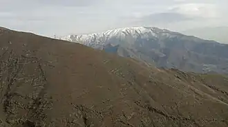
کوه برنگان یک کوه در البرز مرکزی رشته کوه البرز در استان البرز ایران است. این کوه ۲۰۸۴ متر ارتفاع دارد. [۱] [۲] [۳] [۴] [۵] [۶] [۷]
منابع
- ↑ Kūh-e Bārāngan sa Geonames.org (cc-by); post updated 2012-01-21; database download sa 2016-08-15
- ↑ "Viewfinder Panoramas Digital elevation Model". 2015-06-21.
- ↑ "NASA Earth Observations: Population Density". NASA/SEDAC. Archived from the original on 9 February 2016. Retrieved 30 Enero 2016.
{{cite web}}: Check date values in:|access-date=(help) - ↑ "NASA Earth Observations: Land Cover Classification". NASA/MODIS. Archived from the original on 28 February 2016. Retrieved 30 Enero 2016.
{{cite web}}: Check date values in:|access-date=(help) - ↑ Peel, M C; Finlayson, B L. "Updated world map of the Köppen-Geiger climate classification". Hydrology and Earth System Sciences. 11: 1633–1644. doi:10.5194/hess-11-1633-2007. Retrieved 30 Enero 2016.
{{cite journal}}: Check date values in:|access-date=(help) - ↑ "NASA Earth Observations Data Set Index". NASA. Archived from the original on 11 May 2020. Retrieved 30 Enero 2016.
{{cite web}}: Check date values in:|access-date=(help) - ↑ "NASA Earth Observations: Rainfall (1 month - TRMM)". NASA/Tropical Rainfall Monitoring Mission. Archived from the original on 19 April 2019. Retrieved 30 Enero 2016.
{{cite web}}: Check date values in:|access-date=(help)