گارنی (روستا)
گارنی
Գառնի | |
|---|---|
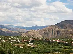 منظره روستای گارنی از زیارتگاه سارگیس مقدس | |
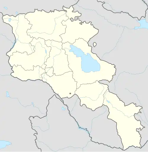 گارنی  گارنی | |
| مختصات: ۴۰°۰۷′۱۰″ شمالی ۴۴°۴۳′۲۳″ شرقی / ۴۰٫۱۱۹۴۴°شمالی ۴۴٫۷۲۳۰۶°شرقی | |
| کشور | |
| استان | کوتایک |
| حکومت | |
| • شهردار | آشوت واردانیان |
| ارتفاع | ۱۴۰۰ متر (۴۶۰۰ فوت) |
| جمعیت (۲۰۱۰) | |
| • کل | ۷۲۳۹ |
| منطقهٔ زمانی | یوتیسی +۴ (AMT) |
| • تابستانی (DST) | یوتیسی +۵ (AMST) |
گارنی (به ارمنی: Գառնի) یک روستا در ارمنستان است که در استان کوتایک واقع شدهاست. گارنی در ۶۳ کیلومتری جنوب هرازدان، مرکز استان کوتایک واقع شدهاست.
خصوصیات
گارنی ۷٬۲۳۹ نفر جمعیت دارد و ۱٬۴۰۰ متر بالاتر از سطح دریا واقع شدهاست.
| سال | ۱۸۹۷ | ۱۹۲۶ | ۱۹۳۹ | ۱۹۵۹ | ۱۹۷۰ | ۱۹۷۹ | ۲۰۰۱ | ۲۰۰۴ |
|---|---|---|---|---|---|---|---|---|
| جمعیت | ۱٬۵۰۷ | ۲٬۸۱۶ | ۳٬۰۸۳ | ۳٬۱۷۶ | ۴٬۵۵۴ | ۵٬۰۱۶ | ۲٬۰۰۴ | ۷٬۶۷۸ |
جاذبههای تاریخی
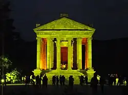
از جاذبه تاریخی این روستا میتوان به معبد گارنی اشاره کرد
نگارخانه


 Map of Garni and the surrounding area
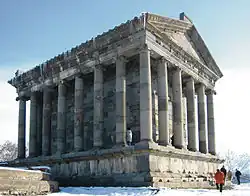 معبد گارنی
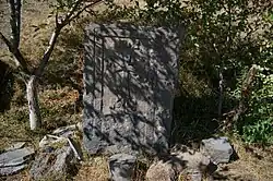
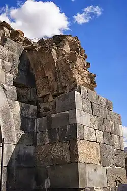
 S. Sion Church foundations adjacent to Garni Temple, 7th to 9th centuries
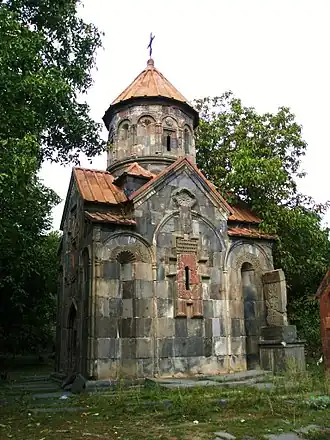 کلیسای ماشتوتس هایراپت، سده ۱۲ام
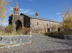 کلیسای آستواوتساتسین مقدس، گانری، سده ۱۱ام
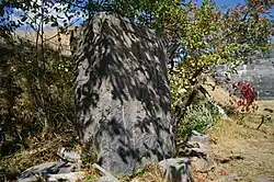
_Church_ruins06.jpg) ویرانههای کلیسای خومارژام (Khonarvats) سدههای ۴ام-۵ام
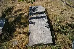
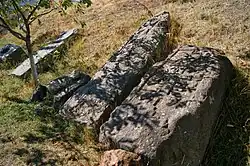
ویرانههای کلیسای خومارژام (Khonarvats) سدههای ۴ام-۵ام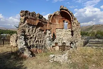 ویرانههای a 4th-century single-aisle chapel at the west side of the Garni cemetery.
.JPG) Garni Gorge "Symphony of the Stones"
Garni Gorge "Symphony of the Stones"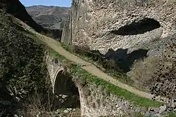 11th-century bridge crossing the Azat River in Garni Gorge (prior to reconstruction)
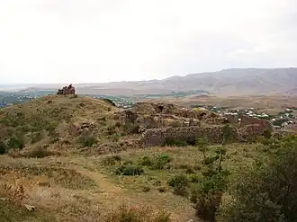 The Havuts Tar Monastic Complex located across the gorge from Garni, 11th-13th centuries
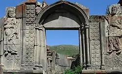 Aghjots Vank of the 13th century located within the Khosrov State Reserve
جستارهای وابسته
منابع
"ԲԱԺԻՆ 1 - Statistical Committee of the Republic of Armenia" (PDF).
- "佩邁赭 慍霄RA KOTAYK MARZ" (PDF).
- Kiesling, John Brady; Kojian, Raffi (June 2000). Rediscovering Armenia: An Archaeological/touristic Gazetteer and Map Set for the Historical Monuments of Armenia. Yerevan/Washington D.C.
- "RA 2001 POPULATION AND HOUSING CENSUS RESULTS" (PDF).
- "RA KOTAYK MARZ" (PDF).
"ԲԱԺԻՆ 1 - Statistical Committee of the Republic of Armenia" (PDF).
- "佩邁赭 慍霄RA KOTAYK MARZ" (PDF).
- Kiesling, John Brady; Kojian, Raffi (June 2000). Rediscovering Armenia: An Archaeological/touristic Gazetteer and Map Set for the Historical Monuments of Armenia. Yerevan/Washington D.C.
- "RA 2001 POPULATION AND HOUSING CENSUS RESULTS" (PDF).
- "YEREVAN - RA CAPITAL" (PDF).
"ԲԱԺԻՆ 1 - Statistical Committee of the Republic of Armenia" (PDF).
- "佩邁赭 慍霄RA KOTAYK MARZ" (PDF).
- Kiesling, John Brady; Kojian, Raffi (June 2000). Rediscovering Armenia: An Archaeological/touristic Gazetteer and Map Set for the Historical Monuments of Armenia. Yerevan/Washington D.C.
- Հայաստանի Հանրապետության բնակավայրերի բառարան. Yerevan. 2008. p. 51.
- مشارکت کنندگان ویکیپدیای انگلیسی. «Garni».
پیوند به بیرون
ویکیسفر یک راهنمای سفر برای
Garni دارد.
در ویکیانبار پروندههایی دربارهٔ گارنی (روستا) موجود است.
- Armeniapedia.org: Garni Village
- Surb Astvatsatsin Church (17th-19th centuries), Garni: photo1, photo2
- Khumarzham (Khonarvats) Church (4th-5th centuries) ruins, Garni: photo1, photo2
- Old Khachkars (Cross-stones), Garni: photo1, photo2, photo3, photo4, photo5
- Surb Astvatsatsin Church (12th century) ruins, Garni: photo1, photo2
- Cave-Fort, Garni
مرکز: هرازدان | ||
| شهرکها | 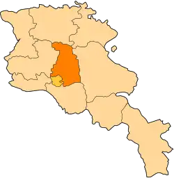 | |
| روستاها |
| |
| روستاهای Non-community | ||
| پیشین (ادغام در هرازدان)[۱] | ||