یونیون (میزوری)
Union, Missouri | |
|---|---|
 Location of Union, Missouri | |
| مختصات: ۳۸°۲۶′۴۸″ شمالی ۹۱°۰′۲۲″ غربی / ۳۸٫۴۴۶۶۷°شمالی ۹۱٫۰۰۶۱۱°غربی | |
| کشور | |
| ایالت | |
| شهرستان | فرانکلین |
| مساحت | |
| • کل | ۹٫۱۶ مایل مربع (۲۳٫۷۲ کیلومتر مربع) |
| • خشکی | ۹٫۱۶ مایل مربع (۲۳٫۷۲ کیلومتر مربع) |
| • آب | ۰ مایل مربع (۰ کیلومتر مربع) |
| ارتفاع | ۵۳۱ فوت (۱۶۲ متر) |
| جمعیت | |
| • کل | ۱۰۲۰۴ |
| • برآورد (2012[۳]) | ۱۰۴۵۶ |
| • تراکم | ۱۱۱۴٫۰/مایل مربع (۴۳۰٫۱/کیلومتر مربع) |
| منطقهٔ زمانی | یوتیسی -۶ (CST) |
| • تابستانی (DST) | یوتیسی -۵ (CDT) |
| زیپکد | ۶۳۰۸۴ |
| کد منطقه | 636 |
| FIPS code | ۲۹-۷۴۶۲۶[۴] |
| GNIS feature ID | ۰۷۲۷۹۵۹[۵] |
یونیون (به انگلیسی: Union) شهری در شهرستان فرانکلین ایالت میزوری است که جمعیت آن در سرشماری سال ۲۰۱۰ میلادی ۱۰٫۲۰۴ نفر بوده است.[۶]
جستارهای وابسته
منابع
- ↑ "US Gazetteer files 2010". United States Census Bureau. Archived from the original on 14 July 2012. Retrieved 2012-07-08.
- ↑ "American FactFinder". United States Census Bureau. Retrieved 2012-07-08.
- ↑ "Population Estimates". United States Census Bureau. Archived from the original on 17 June 2013. Retrieved 2013-05-30.
- ↑ "American FactFinder". United States Census Bureau. Retrieved 2008-01-31.
- ↑ "US Board on Geographic Names". United States Geological Survey. 2007-10-25. Retrieved 2008-01-31.
- ↑ "Missouri: largest cities and towns and statistics of their population" (به انگلیسی). World Gazetteer. Archived from the original on 5 December 2012. Retrieved 12 July 2012.
- Official Manual State of Missouri 2005-2006. Issued by the Secretary of State. Jefferson City, Missouri.
شهرداریها و جوامع شهرستان فرانکلین، میزوری، ایالات متحده | ||
|---|---|---|
| شهرها | 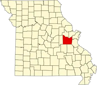 | |
| روستاها |
| |
| تاونشیپها |
| |
| سیدیپیها | ||
| محدوده ثبتنشده |
| |
| شهر متروکه |
| |
| پانویسها | ‡قسمتهایی از این منطقه مسکونی در شهرستانهای اطراف قرار دارد | |