گولمرمره
Gölmarmara | |
|---|---|
District | |
 Location of Gölmarmara within Turkey. | |
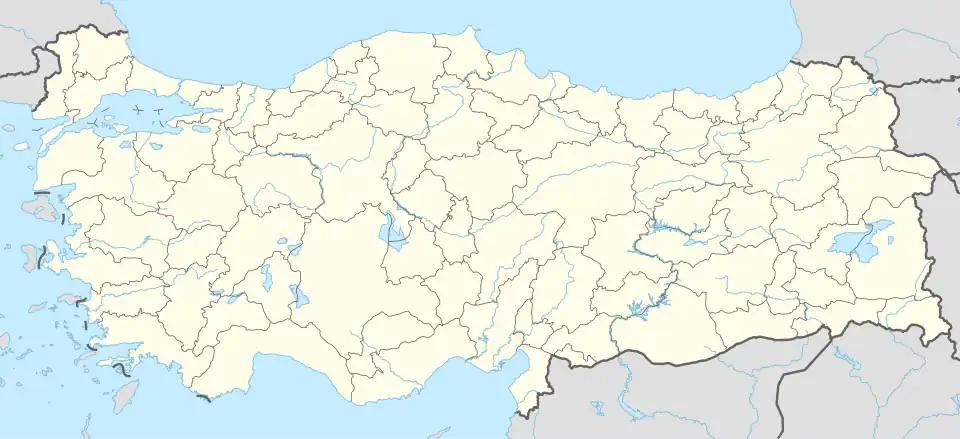 Gölmarmara Location of Gölmarmara | |
| مختصات: ۳۸°۴۳′ شمالی ۲۷°۵۵′ شرقی / ۳۸٫۷۱۷°شمالی ۲۷٫۹۱۷°شرقی | |
| کشور | |
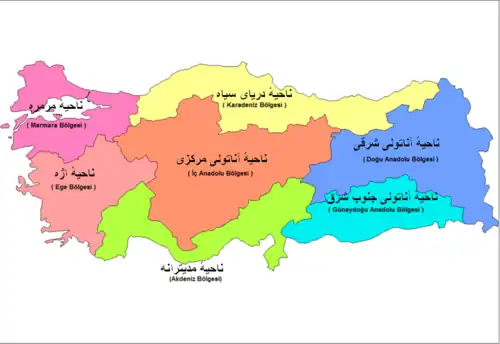
| ناحیه | Aegean |
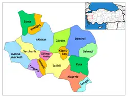
| استان | Manisa |
| مساحت | |
| • District | ۲۸۸ کیلومتر مربع (۱۱۱ مایل مربع) |
| ارتفاع | ۹۱ متر (۲۹۹ فوت) |
| جمعیت (۲۰۰۰)[۱] | |
| • District | ۱۷۸۳۱ |
| • تراکم | ۶۱٫۹۱/کیلومتر مربع (۱۶۰٫۳/مایل مربع) |
| • شهری | ۱۱۲۰۵ |
| منطقهٔ زمانی | یوتیسی +۲ (ساعت) |
| • تابستانی (DST) | یوتیسی +۳ (ساعت تابستانی) |
| کد پستی | 45xxx |
| کد منطقه | ۲۳۶ |
| پلاک وسایل نقلیه ترکیه | ۴۵ |
| وبگاه | www.golmarmara.bel.tr |
گولمرمره (به ترکی استانبولی: Gölmarmara) شهری است در کشور ترکیه که در استان مانیسا واقع شدهاست. جمعیت این شهر بر اساس سرشماری سال ۲۰۰۸ میلادی ۹٬۸۵۷ نفر و بر اساس برآوردهای سال ۲۰۰۹ میلادی ۹٬۷۷۶ نفر میباشد.[۲][۳]
جستارهای وابسته
منابع
- ↑ Turkish Statistical Institute. "Census 2000, Key statistics for urban areas of Turkey" (به ترکی استانبولی). Archived from the original (XLS) on 27 September 2007. Retrieved 2009-04-04.
- ↑ "City, town and village population" (به انگلیسی). TURKISH STATISTICAL INSTITUTE. Archived from the original on 5 December 2012. Retrieved 6 May 2012.
- ↑ "Turkey: largest cities and towns and statistics of their population" (به انگلیسی). World Gazetteer. Archived from the original on 5 December 2012. Retrieved 6 May 2012.
  | ||
| اژه | ||
| دریای سیاه | ||
| آناتولی مرکزی | ||
| آناتولی شرقی | ||
| مرمره | ||
| مدیترانه | ||
| آناتولی جنوب شرق | ||
| ||