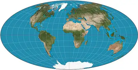
سامانه تصویر آیتوف یا فراتابی آیتوف(به انگلیسی:Aitoffs Projection) نوعی سامانه تصویر نقشه است که در آن تمامی سطح زمین در روی یک بیضی نمایش داده شدهاست تودههای خشکی نزدیک به مرکز نقشه شکل بالنسبه صحیحی دارند اما آنها که نزدیک به حواشی شرقی و غربی هستند به طرز قابل ملاحظهای کج شدهاند.
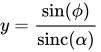
فرمول
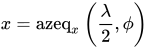
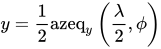
جایی که and are the x and y components of the equatorial azimuthal equidistant projection. Written out explicitly, the projection is:
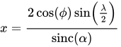
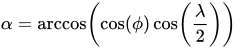
جایی که
و is the unnormalized تابع سینک with the discontinuity removed. In all of these formulas, is the longitude from the central meridian and is the latitude.